Overview
Spectrum Spatial Analyst is an interactive mapping service provided by Pitney Bowes Inc. It provides access to mapping and geographic-based information, addresses and postcode searches. The image given below shows the desktop and mobile view of Spectrum Spatial Analyst application.
Figure: A. Spectrum Spatial Analyst Application- Desktop View
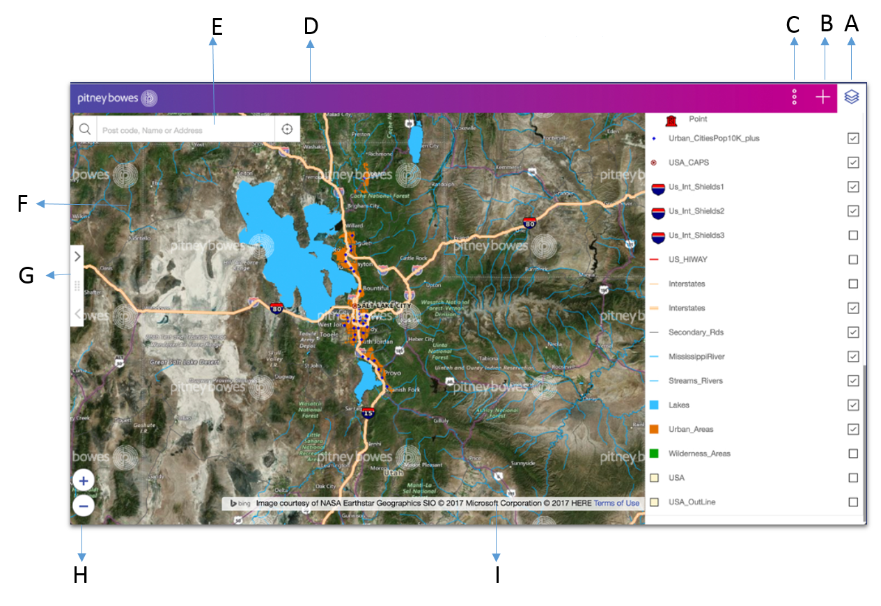
Figure: B. Spectrum Spatial Analyst Application- Mobile view

| Item | Name | Item | Name | Item | Name |
|---|---|---|---|---|---|
| A | Map Legend Panel | B | Add Panel | C | Options Panel |
| D | Banner (optional) | E | Search Addresses | F | Map Area |
| G | Expand/collapse left panel | H | Zoom In and Out (Desktop only) | I | Copyright Information |
Spectrum Spatial Analyst application allows you to:
- Browse current maps and data
- Switch between different background maps such as aerial maps and road maps
- Zoom in and zoom out of maps
- Search and find addresses and postcodes
- Get information about what's on the map by clicking the map
- Search for what services and facilities are nearby to an address
- Search for data within the current map or in a shape you draw
- Search for data using various criteria
- Draw annotations on the map
- Print maps to a PDF file
- Retain X, Y, View and Zoom on switching Map Configuration, if the projections are same.