Location Intelligence Module
Map Uploader
A new Map Uploader utility has been developed for this release. This improved tool allows you to more easily upload maps from MapInfo Pro to Spectrum Spatial. Upon a successful upload, a link to Spatial Manager will allow you to view the map and named resources in the repository. If issues are encountered during the upload process, Map Uploader provides feedback to give you better control of what items are uploaded and guidance on how to modify your map to achieve optimal results.
The new Map Uploader can be used only with MapInfo Pro 16.0 and higher. For Spectrum Spatial Analyst users, version 12.0 of Spectrum Spatial Analyst is also required. The previous version of the Map Uploader is still available for use with MapInfo versions prior to version 16 or Spectrum Spatial Analyst 12.0.
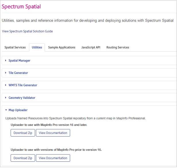
Both tools can be downloaded from the Spectrum Spatial section of the Welcome Page, under Map Uploader on the Utilities tab. Map Uploader documentation is available in the version 12.0 Spectrum Spatial Guide, accessible as a link on the Welcome Page alongside the download link, via the help link in the tool itself, and at support.pb.com/Spectrum. Two versions of the Map Uploader documentation now exist under the Utilities section of the Spectrum Spatial Guide, one for each version of the tool.
As before, the user of the tool is required to have at least spatial-admin rights.
What's Changed
The new Map Uploader is significantly different than the previous version.- You no longer need to turn all layers on in MapInfo Pro prior to the upload for them to be available in Spectrum Spatial.
- The initial map view will respect the visibility settings as they are in MapInfo Pro. Applications can choose to display or not display any of the layers in the map as in MapInfo Pro.
- Label overlap detection and label display priority will be respected across all the layers of the map as they are designed in MapInfo Pro.
- Label layer settings are uploaded regardless of whether the labels are visible or not. For more information, see Named Label Sources.
- Label and display overrides controlled by zoom level are preserved in the uploaded map.
- File-based data such as MapInfo native TAB, native extended TAB, shapefile, and GeoPackage can be located on the server in multiple locations. The previous version only searched one connection that was set on the settings tab. Both read and write permissions are required to browse GeoPackage files.
- The map that you load is saved in the location of the repository that you choose. In the earlier version, a NamedMaps folder was always created underneath the chosen location.
- The named tables and layers created by the Map Uploader preserve the names used in MapInfo Pro. As layers and tables can often have the same name, named layers and label sources are created in a subfolder unique to that map. Named tables are created in the same folder as the map.
- The Map Uploader will clearly indicate when new tables are being created and when existing ones are being reused. A map that is being corrected by overwriting it will preserve any of the existing named resources used by the existing map.
- Thematic maps are supported with the exception of half-pie charts.
- There is no longer a need to log in for each map upload. The uploader stays connected to the server until you sign out.
- The Map Uploader is fully integrated into the MapInfo Pro Add In environment including the ability to be docked, floating or tabbed and has a "backstage" place for settings that will be expanded in the future.
Upgrading to the New Map Uploader
Be aware that when you install the new Map Uploader, it will detect your settings from the configuration file for the previous Map Uploader and recognize the connection saved there. When you use the new Map Uploader, that connection will be used first if there are multiple connections available.
Updates to Map Uploader for 12.0
The new Map Uploader (version 2.0) was initially released as part of the S12 update for 11.0 SP1. Several fixes and additions have been made for the 12.0 release and Map Uploader 2.1.
- The "All others" bin for an individual value theme was removed from the legend.
- A ranged theme is based on the user's choice in MapInfo Pro.
- Labels from multiple layers on the same table now work correctly.
- Ranged theme and topmost bin matching exact value now working.
- Raster overrides are now available for translucency, transparency, and transparent color.
- A resource can now be saved in the root without throwing an error.
- To support Spectrum Spatial Analyst, commas were removed from map names.
- Warnings now display when named tables are not useable.
- Better ordering of named connections based on previous usage is now provided.
- You can now override the connection that is used.
- Timeouts are handled better. The default timeout is 150 seconds.
- Scale setting for bar and pie themes was added to make them display correctly.
- The setting of the friendly layer name was corrected so that it appears in the legend response.
- Better control was added for auto-resizing.
- Label visibility is similar to MapInfo Pro when using themes. Labels will also display with the layer off as they do in MapInfo Pro.
- Caching of named connections used was added.
- To support reuse, Map Uploader can now differentiate between named tables that reference a file or a database.
- Automatic transform was added when expressions involve coordinates, as MapInfo Pro’s "current coordsys" may not be table coordsys.
- The home page updates to the current map if needed.
- The tree control "remembers" the previous location.
- Handling exception when an existing named table had the same name as the table used in the MapInfo Pro map, and this table is used more than once in the map.
- The Map Uploader tool displays as docked when used for the first time.
- Map Uploader used to display an empty root when there was an expired token. It now renews the token seamlessly.
- The tree now supports double-click opening of folders.
- Independent scales now works for bar themes.
- Map Uploader now handles browsing a GeoPackage file when the user has read-only access to it.
- The user is now informed of the different operations that take place after clicking the Continue button, which starts the Data Match operation.
Known Issues with Older Versions
- ECW may not be working on the server depending on other software that is installing Microsoft C Runtime 100.
- The "All others" bin for an individual value theme always shows in the legend.
- The MapInfo POI font may be unusable. The workaround is to install the fixed one that comes with 12.0.
Performance Enhancements
Performance has been enhanced in several areas of Spectrum Spatial:
- The Find Nearest and Point in Polygons stages have been redesigned, resulting in faster analysis.
- Transforming coordinate systems, particularly WGS84 to BNG, is now faster in Spectrum Spatial.
- Performance has been improved when accessing the spatial repository, particularly when using Spatial Manager and operations that interact with multiple resources such as Render Named Map and the Map Tiling service.
WFS Enhancement
Support has been added for WFS 2.0 (versions 2.0.0 and 2.0.2) to align with MapInfo Pro version 16.0.
WMTS Enhancements
When creating a WMTS layer in Spatial Manager, there are no longer any restrictions on the named tile selected as the reference tile, either for tile level or coordinate system in the named tile. In the previous release, WMTS was restricted to allowing tiles in Popular Visualization CRS (Popular or Spherical Mercator) [epsg:3857]. You can now configure a WMTS service to return a tile in any coordinate system in any bounds, just like the Map Tiling Service allows today. Specifically, the Longitude / Latitude (WGS 84) [epsg:4326] coordinate system is now supported. All requirements for the OGC WMTS Simple Profile specification are now implemented. For more information see the OGC Services section in the Spectrum Spatial Guide.
Tile caching that is similar to the caching provided for the Map Tiling service is now available for WMTS. WMTS tile caching is disabled by default, but can be enabled and configured using Spatial Manager. Using image caching strategies to serve pre-rendered, georeferenced map tiles helps provide a performance-oriented and scalable service to WMTS users.
WMS Enhancement
When creating or editing a WMS layer in Spatial Manager, you can now select named tables for reference layers in addition to named layers. When selecting a named table as a reference layer, you also have the option to select a default style for rendering the table.
Named Label Sources
A new type of named resource has been added to Spectrum Spatial called a named label source. Named label sources contain the same label properties that are stored in the LabelSource section of the layer definition XML. Named label sources are created when a map is uploaded from MapInfo Pro using the Map Uploader utility.
A named label source is like any other named resource in regards to permissions and reuse. Named label resources can also be imported or exported using the limrepo commands in the Administration Utility, copied to and from the Spatial repository via WebDAV, and viewed and managed (but not created) in Spatial Manager. Sample named label sources are provided in the /Samples folder as part of this release.
NamedFeatureLabelSource). This requires all validating clients of the Named
Resource Service to be rebuilt.Label Visibility Control
Using a named label source now allows for labels from multiple tables with no overlap and full interactive control in a client application. A label layer, named or inline, can contain named label sources which in turn contain the same label properties that can be stored in the LabelSource section of the XML.
Feature Layer References to Named Label Sources
A feature layer can now reference a named label source. A new attribute,
namedLabelSourceRef, can optionally be used in a feature layer definition
to indicate which named label source a client can use to label the feature layer with. The
new version of the Map Uploader creates feature layers with this reference in place. The
sample feature layers in the /Samples/NamedLayers folder are also
updated with references to name label sources as part of this
release
REST Methods
A new method, Describe Named Label Sources, has been added to the REST Mapping Service. The label source portions of the response from this describe can be incorporated in the label layer section of a map definition, which can then be used in a REST Render Map or Render Map Legend request, for example, to help determine the visibility of its labels.
The Describe Named Layer and Describe Named Layers methods in the REST Mapping Service have been enhanced to describe named label sources contained within label layers. When describing a label layer with an inline label source, these methods return a full description of the label source. When describing a label layer with a named label source, they return a reference to the named label source. The layer portions of the response from this describe can be incorporated in a map definition, which can then be used in a REST Render Map or Render Map Legend request.
Labels, like feature layers, are displayed or not displayed based on their existence in a
label layer as part of a Render Map or Render Map Legend request. You can set the
renderable property in the JSON body of a POST request to override the
visibility of the named label source. Using the SOAP versions of these requests will return
the details of a named label source but not the named label source itself.
For more information about named label sources, feature layer definitions, and controlling label visibility in the REST Render Map request, see the Spectrum Spatial Guide.
Distance to Edge Function
The MI_DistanceToEdge geometry measurement function has been added to the MI SQL language and the Spatial Calculator stage. This function returns the distance between two geometries using distance units. Specifically, the distance between two closest points of the two geometries is determined. When a geometry is inside another geometry, the shortest distance between the two geometries is returned with a positive distance value.
Find Nearest and Point in Polygon Stages
New stages for Find Nearest and Point in Polygon have been created to improve usability as well as interoperability with stages in the Enterprise Geocoding Module, Global Geocoding Module and the Enterprise Routing Module. The original stages have both been deprecated and renamed Legacy Point in Polygon and Legacy Find Nearest. The new stages should be used when creating a new dataflow. Any existing dataflows that use these deprecated stages will continue to function properly until the stages are removed.
The redesigned Point in Polygon stage takes either a point geometry or latitude and longitude values as well as a named table containing polygons to return the points within the polygon. It also returns the distance of the point to the edge of the polygon and replaces the Centrus "Distance to Edge" functionality in the original Point in Polygon stage. This redesigned version of the stage no longer supports the GSB (Centrus database) format. When migrating dataflows to the new stage, the data in the GSB files must be obtained in either TAB or shapefile format.
The redesigned Find Nearest stage will return the same geometries as the Point in Polygon stage plus those geometries that are nearest the input point, while still respecting limits set for distance and number of records returned. The redesigned stage does not yet support the option of refining the search using the routing network. If you were using the search criteria options of "fastest" or "shortest," you should continue to use the Legacy stage until this capability is added to the redesigned Find Nearest stage.
Both redesigned stages use the new Distance to Edge filter and as a result demonstrate improved performance, particularly for Point In Polygon which no longer uses Centrus databases.
Map Image Quality
To improve the quality of generated map images, the ability to change map rendering to Quality (anti-aliasing on) or Speed (anti-aliasing off) as part of a REST or SOAP Mapping Service request has been disabled. Map rendering is now set to Quality.
As an alternative to the default Java render, we have also tested the open-source Marlin renderer which can provide higher performance and scalability. See the Development section of the Spectrum Spatial Guide for instructions on using the Marlin renderer with Spectrum Spatial.
Mapping Service Enhancements
- Legends can now be created for maps with a dot density theme.
- The ability to render legends has been added to the Mapping Service demo page.
- In the REST Mapping Service, a new query parameter (ignoreLegendRowOverrideVisibility) for the Get Legend for a Named Map and Render Legend for a Map methods allows you to ignore the LegendRowOverride visibility setting in the named resource and returns all legends.
MRR Enhancements
Spectrum Spatial now supports MRR files that have been generated using MapInfo Pro Raster 3.0. MRR images and legends rendered in Spectrum Spatial now more closely match those of MapInfo Pro.
PostGIS Geometries Enhancement
When inserting or updating geometries for PostGreSQL/PostGIS, upcasting and downcasting of geometries are now supported.
For example:
- Polygon geometries can be inserted into tables that are configured to accept geometries of a MultiPolygon type.
- MultiPolygon geometries can be inserted into tables that are configured to accept geometries of a Polygon type if the MultiPolygon contains a single Polygon.
Service Configuration Improvements
Some improvements to the service configurations have been made, including the removal of the repository location in each service configuration file. This makes configuring Spectrum Spatial easier by providing a single location for changing the repository URL in the java.properties file.
All service configuration files will be modified as part of the upgrade process to reflect these changes except for the Named Resource Service and User Management Service, which were removed for this release as they are no longer needed. As of this release, the remaining service configurations are:
- FeatureConfiguration
- Mapping Configuration
- MapTilingConfiguration - OSBM pooling settings have also been removed
- WFSConfiguration
- WMSConfiguration
- WMTSConfiguration
If you back up and restore configuration files from a previous version using the limrepo export and import commands in the Administration Utility, the configuration files will be modified to be compliant with version 12.0.
GeoPackage Enhancements
An RTree index is no longer mandatory, but is recommended to prevent performance issues.
Renamed Sample Connection
The FileNamedConnection in the sample named resources (/Samples/NamedConnections/FileNamedConnection) has been renamed to SampleData. This sample connection has been renamed to emphasize its status as a sample; samples are supplied for learning about Spectrum Spatial. During an upgrade it could change or be removed. Other than a temporary demonstration, it is recommended that you do not use the sample data for your own maps. If you used the FileNamedConnection in a previous release, simply use Spatial Manager to rename the connection.
New MapInfo SQL Function
The StringByteLength function has been added to the MapInfo SQL language. This string function returns the number of bytes in a string for a given charset. This is useful, for example, when you need to determine maximum column widths for a table.
New Coordinate Ellipsoid Definitions
- #56 - GSK-2011
- #57 - PZ-90.11