| diagram |
|
||||||||||||
| namespace | http://www.mapinfo.com/mxp | ||||||||||||
| properties |
|
||||||||||||
| children | gml:MultiSurface | ||||||||||||
| used by |
|
||||||||||||
| attributes |
|
||||||||||||
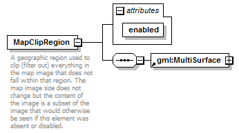
| description |
|
attribute MapClipRegion/@enabled
| type | xs:boolean | ||
| properties |
|