complexType GraduatedSymbolLayer
diagram mapping_p178.png
namespace http://www.mapinfo.com/midev/service/mapping/v1
type extension of tns:Layer
properties
base   tns:Layer
children tns:VisibilityConstraintList tns:Table tns:PositiveSymbol tns:NegativeSymbol tns:SymbolBaseSize
attributes
Name    Type    Use    Default    Fixed    Annotation
renderable    xsd:boolean    optional    true      
Disable the rendering of this layer.
description    xsd:string            
The name/description for this layer.
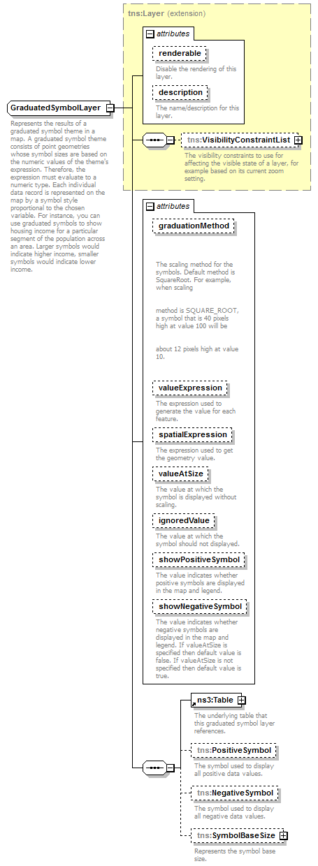
graduationMethod    tns:GraduationMethod    optional    SQUARE_ROOT      

The scaling method for the symbols. Default method is SquareRoot. For example, when scaling
method is SQUARE_ROOT, a symbol that is 40 pixels high at value 100 will be
about 12 pixels high at value 10.
valueExpression    xsd:string            
The expression used to generate the value for each feature.
spatialExpression    xsd:string    optional         
The expression used to get the geometry value.
valueAtSize    xsd:double    optional         
The value at which the symbol is displayed without scaling.
ignoredValue    xsd:double    optional         
The value at which the symbol should not displayed.
showPositiveSymbol    xsd:boolean    optional    true      
The value indicates whether positive symbols are displayed in the map and legend.
showNegativeSymbol    xsd:boolean    optional         
The value indicates whether negative symbols are displayed in the map and legend. If valueAtSize is specified then default value is false. If valueAtSize is not specified then default value is true.
description
Represents the results of a graduated symbol theme in a map. A graduated symbol theme consists of point geometries whose symbol sizes are based on the numeric values of the theme's expression. Therefore, the expression must evaluate to a numeric type. Each individual data record is represented on the map by a symbol style proportional to the chosen variable. For instance, you can use graduated symbols to show housing income for a particular segment of the population across an area. Larger symbols would indicate higher income, smaller symbols would indicate lower income.

attribute GraduatedSymbolLayer/@graduationMethod
type tns:GraduationMethod
properties
use   optional
default   SQUARE_ROOT
facets
Kind   Value   Annotation
enumeration   SQUARE_ROOT
A symbol that is 40 pixels high at value 100 will be about 12 pixels high at value 10.
enumeration   LOGARITHM
A symbol that is 40 pixels high at value 100 will be 20 pixels high at value 10.
enumeration   CONSTANT
A symbol that is 40 pixels high at value 100 will be 4 pixels high at value 10.
description

The scaling method for the symbols. Default method is SquareRoot. For example, when scaling
method is SQUARE_ROOT, a symbol that is 40 pixels high at value 100 will be
about 12 pixels high at value 10.

attribute GraduatedSymbolLayer/@valueExpression
type xsd:string
description
The expression used to generate the value for each feature.

attribute GraduatedSymbolLayer/@spatialExpression
type xsd:string
properties
use   optional
description
The expression used to get the geometry value.

attribute GraduatedSymbolLayer/@valueAtSize
type xsd:double
properties
use   optional
description
The value at which the symbol is displayed without scaling.

attribute GraduatedSymbolLayer/@ignoredValue
type xsd:double
properties
use   optional
description
The value at which the symbol should not displayed.

attribute GraduatedSymbolLayer/@showPositiveSymbol
type xsd:boolean
properties
use   optional
default   true
description
The value indicates whether positive symbols are displayed in the map and legend.

attribute GraduatedSymbolLayer/@showNegativeSymbol
type xsd:boolean
properties
use   optional
description
The value indicates whether negative symbols are displayed in the map and legend. If valueAtSize is specified then default value is false. If valueAtSize is not specified then default value is true.

element GraduatedSymbolLayer/PositiveSymbol
diagram mapping_p179.png
namespace http://www.mapinfo.com/midev/service/mapping/v1
type tns:Style
properties
minOcc   0
maxOcc   1
content   complex
description
The symbol used to display all positive data values.

element GraduatedSymbolLayer/NegativeSymbol
diagram mapping_p180.png
namespace http://www.mapinfo.com/midev/service/mapping/v1
type tns:Style
properties
minOcc   0
maxOcc   1
content   complex
description
The symbol used to display all negative data values.

element GraduatedSymbolLayer/SymbolBaseSize
diagram mapping_p181.png
namespace http://www.mapinfo.com/midev/service/mapping/v1
type tns:BaseSize
properties
minOcc   0
maxOcc   1
content   complex
children tns:MapScale
attributes
Name    Type    Use    Default    Fixed    Annotation
useScale    xsd:boolean       true      
If true the size of bar or pie changes with map scale, otherwise false.
description
Represents the symbol base size.


© 2016 Pitney Bowes Software Inc. Email: pbbi.support@pb.com