|
diagram
|
|
|
namespace
|
http://www.mapinfo.com/midev/service/geometry/v1
|
|
type
|
extension of
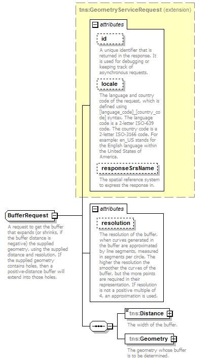
tns:GeometryServiceRequest
|
|
properties
|
|
base
|
tns:GeometryServiceRequest
|
|
|
children
|
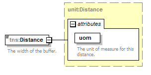
tns:Distance
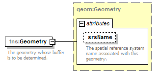
tns:Geometry
|
|
used by
|
|
|
attributes
|
|
Name
|
Type
|
Use
|
Default
|
Fixed
|
Annotation
|
|
id
|
xsd:string
|
optional
|
|
|
|
|
A unique identifier that is returned in the response. It is used for debugging or keeping track of asynchronous requests.
|
|
|
locale
|
xsd:string
|
optional
|
|
|
|
|
The language and country code of the request, which is defined using [language_code]_[country_code] syntax. The language code is a 2-letter ISO-639 code. The country code is a 2-letter ISO-3166 code. For example: en_US stands for the English language within the United States of America.
|
|
|
responseSrsName
|
xsd:string
|
optional
|
|
|
|
|
The spatial reference system to express the response in.
|
|
|
resolution
|
xsd:int
|
optional
|
12
|
|
|
|
The resolution of the buffer, when curves generated in the buffer are approximated by line segments, measured in segments per circle. The higher the resolution the smoother the curves of the buffer, but the more points are required in their representation. If resolution is not a positive multiple of 4, an approximation is used.
|
|
|
|
description
|
|
|
A request to get the buffer that expands (or shrinks, if the buffer distance is negative) the supplied geometry, using the supplied distance and resolution. If the supplied geometry contains holes, then a positive-distance buffer will extend into those holes.
|
|