| diagram |
|
||
| namespace | http://www.mapinfo.com/midev/service/maptiling/resource/v1 | ||
| properties |
|
||
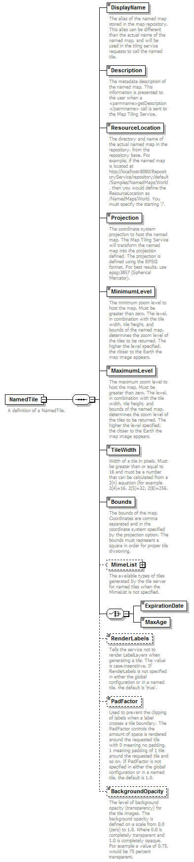
| children | DisplayName Description ResourceLocation Projection MinimumLevel MaximumLevel TileWidth Bounds MimeList ExpirationDate MaxAge RenderLabels PadFactor BackgroundOpacity | ||
| description |
|
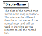
element NamedTile/DisplayName
| diagram |
|
||
| namespace | http://www.mapinfo.com/midev/service/maptiling/resource/v1 | ||
| type | xs:string | ||
| properties |
|
||
| description |
|
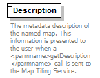
element NamedTile/Description
| diagram |
|
||
| namespace | http://www.mapinfo.com/midev/service/maptiling/resource/v1 | ||
| type | xs:string | ||
| properties |
|
||
| description |
|
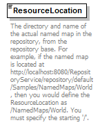
element NamedTile/ResourceLocation
| diagram |
|
||
| namespace | http://www.mapinfo.com/midev/service/maptiling/resource/v1 | ||
| type | xs:string | ||
| properties |
|
||
| description |
|
element NamedTile/Projection
| diagram |
|
||
| namespace | http://www.mapinfo.com/midev/service/maptiling/resource/v1 | ||
| type | xs:string | ||
| properties |
|
||
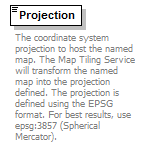
| description |
|
element NamedTile/MinimumLevel
| diagram |

|
||
| namespace | http://www.mapinfo.com/midev/service/maptiling/resource/v1 | ||
| type | xs:int | ||
| properties |
|
||
| description |
|
element NamedTile/MaximumLevel
| diagram |
|
||
| namespace | http://www.mapinfo.com/midev/service/maptiling/resource/v1 | ||
| type | xs:int | ||
| properties |
|
||
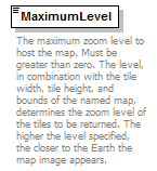
| description |
|
element NamedTile/TileWidth
| diagram |
|
||
| namespace | http://www.mapinfo.com/midev/service/maptiling/resource/v1 | ||
| type | xs:int | ||
| properties |
|
||
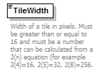
| description |
|
element NamedTile/Bounds
| diagram |
|
||
| namespace | http://www.mapinfo.com/midev/service/maptiling/resource/v1 | ||
| type | xs:string | ||
| properties |
|
||
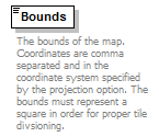
| description |
|
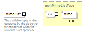
element NamedTile/MimeList
| diagram |
|
||||||
| namespace | http://www.mapinfo.com/midev/service/maptiling/resource/v1 | ||||||
| type | MimeListType | ||||||
| properties |
|
||||||
| children | Mime | ||||||
| description |
|
element NamedTile/ExpirationDate
| diagram |
|
||
| namespace | http://www.mapinfo.com/midev/service/maptiling/resource/v1 | ||
| type | ExpirationDateType | ||
| properties |
|
element NamedTile/MaxAge
| diagram |

|
||
| namespace | http://www.mapinfo.com/midev/service/maptiling/resource/v1 | ||
| type | xs:int | ||
| properties |
|
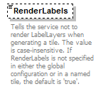
element NamedTile/RenderLabels
| diagram |
|
||||||
| namespace | http://www.mapinfo.com/midev/service/maptiling/resource/v1 | ||||||
| type | RenderLabelsType | ||||||
| properties |
|
||||||
| description |
|
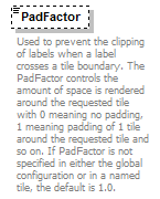
element NamedTile/PadFactor
| diagram |
|
||||||
| namespace | http://www.mapinfo.com/midev/service/maptiling/resource/v1 | ||||||
| type | PadFactorType | ||||||
| properties |
|
||||||
| description |
|
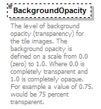
element NamedTile/BackgroundOpacity
| diagram |
|
||||||
| namespace | http://www.mapinfo.com/midev/service/maptiling/resource/v1 | ||||||
| type | BackgroundOpacityType | ||||||
| properties |
|
||||||
| description |
|